
Page 77 - KBHA Bulletin 13
P. 77
74
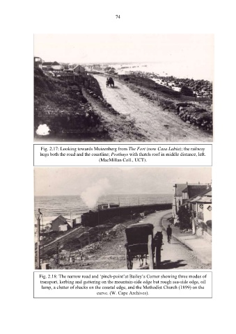
Fig. 2.17: Looking towards Muizenberg from The Fort (now Casa Labia); the railway
hugs both the road and the coastline; Posthuys with thatch roof in middle distance, left.
(MacMillan Coll., UCT).
Fig. 2.18: The narrow road and ‘pinch-point’at Bailey’s Corner showing three modes of
transport, kerbing and guttering on the mountain-side edge but rough sea-side edge, oil
lamp, a clutter of shacks on the coastal edge, and the Methodist Church (1899) on the
curve. (W. Cape Archives).