
Page 64 - KBHA Bulletin 14
P. 64
60
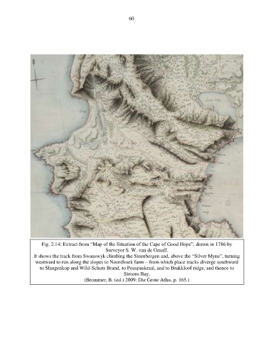
Fig. 2.14: Extract from “Map of the Situation of the Cape of Good Hope”, drawn in 1786 by
Surveyor S. W. van de Graaff.
It shows the track from Swanswyk climbing the Steenbergen and, above the “Silver Myne”, turning
westward to run along the slopes to Noordhoek farm – from which place tracks diverge southward
to Slangenkop and Wild-Schuts Brand, to Pouspaskraal, and to Brakkloof ridge, and thence to
Simons Bay.
(Brommer, B. (ed.) 2009: Die Grote Atlas, p. 165.)