


Page 65 - KBHA Bulletin 14
P. 65
61


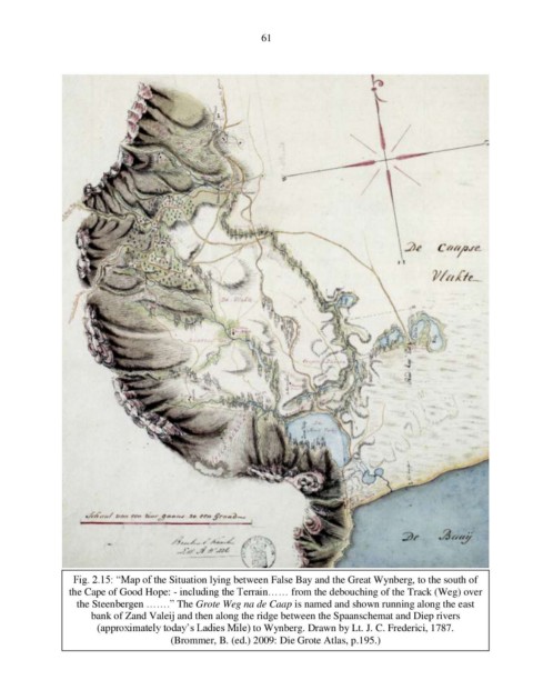
                  Fig. 2.15: “Map of the Situation lying between False Bay and the Great Wynberg, to the south of
                  the Cape of Good Hope: - including the Terrain…… from the debouching of the Track (Weg) over

                   the Steenbergen …….” The Grote Weg na de Caap is named and shown running along the east
                      bank of Zand Valeij and then along the ridge between the Spaanschemat and Diep rivers
                       (approximately today’s Ladies Mile) to Wynberg. Drawn by Lt. J. C. Frederici, 1787.
                                        (Brommer, B. (ed.) 2009: Die Grote Atlas, p.195.)

